The following is a short essay from Ringer Squire. Do you agree? Disagree? Share your responses with our discuss or comment areas.
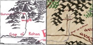
Headlined here yesterday, and discussed on the Main board just now is a link to an entertaining new interactive map of Middle-earth. It’s modeled on Google Earth, in that one can zoom out and see the whole subcontinent, or zoom in and see individual towns and towers close up. Of course it follows Tolkien’s own map, more or less exactly, but it has in fact been redrawn via computer by a new artist, Mr. Kris Kowal. And when you zoom in you see little bits that Tolkien could not or would not include in his original map, like icons representing the Argonath, the road to Isengard (see illustration below), and the ruined tower on Weathertop. Several place names have been added based on texts in Unfinished Tales, like the “Undeeps” of the middle Anduin, so the creators are clearly knowledgeable about their Tolkien geography.

I understand that it is a work in progress, so perhaps we may expect to see more of the details of the Shire in the future, based on the separate map that appears in Fellowship. But really, the power of zooming in, which is so much fun in Google Earth, is disappointing in this “Google Middle-earth”. There’s nothing to zoom in to for 99% of the world—and there never will be. Tolkien only drew on his map the specific places that were mentioned in his story; and for anyone to add anything else is, of course, just another form of fan-fiction.
This new map thus surprisingly reminds us just how poorly Tolkien detailed his physical world. The map, and several recent discussions we have had in the Reading Room about the distribution of hobbit-folk and the political organization of the Rangers, bring me back to an old question. Tolkien expressed his belief that one of the aesthetic virtues of The Lord of the Rings is that it contained hints of the earlier history of the world, but only hints.
“…part of the ‘fascination’ [of The Lord of the Rings] consists in the vistas of yet more legend and history, to which this work does not contain a full clue. For the present we had better leave it at that.” (J.R.R. Tolkien, Letter #151, 18 September 1954)
“…those who enjoy the book as an ‘heroic romance’ only, and find ‘unexplained vistas’ part of the literary effect, will neglect the appendices, very properly.” (JRRT, Letter #160, 6 March 1955)
When he was writing LotR, his Silmarillion texts had long been in existence, and he drew on them repeatedly for legends, tales, myths, and names, brilliantly evoking an ancient past that gave a great sense of reality to the foreground tale of the Ring. After The Lord of the Rings was published, and he was encouraged to finish up the earlier work for a ready audience, he worried that to make the hints concrete, to tell the stories in full – in other words, to publish The Silmarillion – might lessen the beauty of LotR. He also feared that the Silmarillion tales might not be as successful as LotR for a general audience, because they themselves have no further “backdrop” and exist by themselves, naked in time.
“I am doubtful myself about the undertaking [publishing The Silmarillion]. Part of the attraction of The L.R. is, I think, due to the glimpses of a large history in the background : an attraction like that of viewing far off an unvisited island, or seeing the towers of a distant city gleaming in a sunlit mist. To go there is to destroy the magic, unless new unattainable vistas are again revealed.” (JRRT, Letter #247, 20 September 1963)
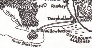
Compared to Tolkien’s fully-imagined approach to the uses of time to deepen the legends of the Third Age, his famous Map appears to be a rather unsatisfactory use of space. That is, there are no “unexplained vistas”. I don’t mean that there are no empty spaces on the map – there are plenty. I mean that there are almost no place-names or features on the map that do not get mentioned in the story. The map organizes the world that we read about, but it does not extend it. Only in the detail map of the Shire (see illustration below) are there some villages or districts that do not appear in the text, showing that Tolkien was fully capable of this kind of invention. (Tellingly, in Letter 276 he implies that his motive was purely the fun of creating realistic names based on English Midlands models.)

But nowhere else in the entirety of Middle-earth do we see any hints of other settlements, trade routes, or physical features, which would imply that this fabulous world is even more mysterious and story-filled than the parts we read about in the text.
My point is not that Tolkien thus makes it harder for us to puzzle out where the Rangers lived, or how many people Gondor had. It’s that Tolkien seems to have resisted the idea that world-creation can be done in other ways than through language. He wrote stunning descriptions of landscapes. He wrote about a multitude of magical lands and kingdoms. He scattered legends and other textual references to earlier times throughout his narratives. He named almost everything in Elvish. Even when he laid out his chronologies in timeline fashion, as organizing tools for his existing history, he invariably began embroidering the entries with additional tales.
But for a man whose talents as a visual artist were considerable, he seems to have resisted seeing a map as another excellent way to sub-create a world. His maps were always just organizers: they only echoed the text, they never extended it. They don’t tell us, all by themselves, that further stories exist. There are no “unvisited islands” that are not mentioned in the book; no “towers of a distant city gleaming in a sunlit mist” that aren’t seen by a member of the Fellowship.
Do you agree with Squire’s essay? As his opinions are not those of TheOneRing.net, we welcome your feedback and response. Please use the ‘discuss’ or ‘comment’ area to share your thoughts.


